Tell your friends about this item:
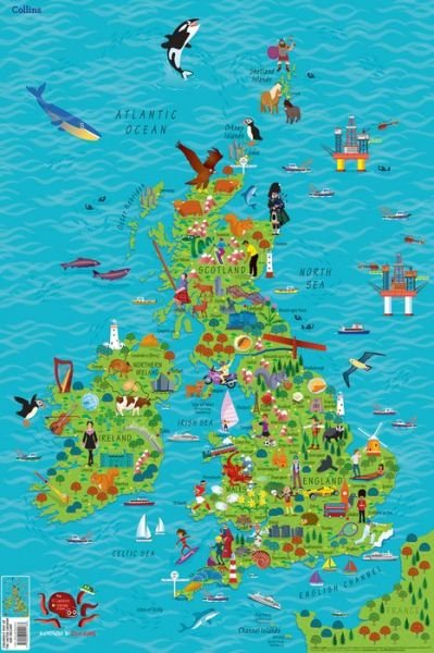
Children’s Wall Map of the United Kingdom and Ireland: Ideal Way for Kids to Improve Their Uk Knowledge Collins Kids


Children’s Wall Map of the United Kingdom and Ireland: Ideal Way for Kids to Improve Their Uk Knowledge
Collins Kids
Colourful Illustrated Map of the United Kingdom and Ireland
| Media | Books Map (Land or nautical charts) |
| Released | May 4, 2017 |
| ISBN13 | 9780008212087 |
| Publishers | HarperCollins Publishers |
| Dimensions | 610 × 716 × 3 mm · 140 g |
| Illustrator | Evans, Steve |
More by Collins Kids
Show all![Cover for Collins Kids · Collins Children’s World Wall Map: An Illustrated Poster for Your Wall (Map) [2 Revised edition] (2019)](https://imusic.b-cdn.net/images/item/original/793/9780008319793.jpg?collins-kids-2019-collins-children-s-world-wall-map-an-illustrated-poster-for-your-wall-map&class=scaled&v=1556804487)
Mere med samme udgiver


![Cover for Dr. Seuss · One Fish Two Fish Red Fish Blue Fish - Learn With Dr. Seuss (Paperback Book) [Learn With Dr. Seuss edition] (2028)](https://imusic.b-cdn.net/images/item/original/349/9780008592349.jpg?dr-seuss-2028-one-fish-two-fish-red-fish-blue-fish-learn-with-dr-seuss-paperback-book&class=scaled&v=1667831653)
See all of Collins Kids ( e.g. Paperback Book , Hardcover Book , Loose-leaf , CD and Map )